")
")
GIS-REMOTE SENSING LABORATORY
- Introduction
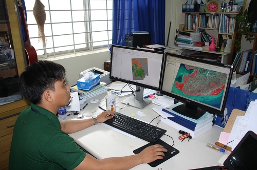
GIS-Remote Sensing Laboratory, under the Department of Land Resources, was established to teach and carry out advanced research related to the application of remote sensing and spatial analysis in natural resource management. It also serves as a place for lecturers and students to create ideas in the field of remote sensing and spatial analysis for monitoring of land, environment and water resources.
- STAFF MEMBERS AND RESEARCH FOCUSES:
|
No |
Full name |
Gender |
DOB |
Background |
Position |
|
1 |
M |
1978 |
Remote sensing/Ecosystem services valuation |
Head of GIS-Remote sensing Lab. |
|
|
2 |
Vo Quang Minh ( Professor) |
M |
1962 |
GIS, Remote sensing, Soil Science |
|
|
3 |
Nguyen Thi Hong Diep (Assoc. Prof) |
F |
1971 |
GIS, Remote sensing |
|
|
4 |
Truong Chi Quang (PhD) |
M |
1978 |
Modelling, GIS, Remote sensing |
|
|
5 |
Huynh Thi Thu Huong (PhD) |
F |
1973 |
GIS, Remote sensing |
|
|
6 |
Phan Kieu Diem (PhD) |
F |
1983 |
GIS, Remote sensing |
|
- TEACHING AND TECHNOLOGY TRANSFER ACTIVITIES
Teaching for under-graduate students:
- Land Management
- Silviculture
- Soil Science
- Environment and Natural Resources Management
- Crop Sciences
- Landscape Design
- Environment Technology
- Civil Engineering
- Rural development.
Courses taught for other majors
- Geographic Information System (GIS)
- Land Information System (LIS/LIM)
- Global Positioning System (GPS)
- Database management system for natural resources
- Remote sensing technology
- Basic remote sensing
- Advanced remote sensing
- Applied remote sensing in environment management
- Applied GIS and Remote sensing in Agriculture
- Application of GIS and Remote sensing in Land use planning
- Application of GIS and remote sensing in Landscape design
- Applied Remote sensing for Land management
- Cadastral Surveying
- Cadastral Map Technology
- Supervising graduate and under-graduate students in different majors such as Soil science, Land management, Crop science, Agronomy, Soil Science, Environment and Natural Resources Management, Landscape Design, Environment Technology, Civil Engineering Rural development.
Teaching for graduate students
- Land management
- Soil Science
- Environment management
Teaching courses
- Applied Informatics for Land management
- Application of GIS in environment assessment
- Application of GIS and Remote sensing in Rural development planning
- GIS and remote sensing application in plant protection
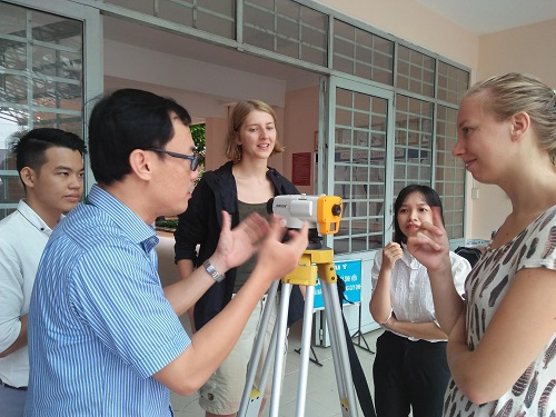
Short training courses
- Application of GIS and Remote sensing in Land use planning
- Application of GIS and Remote sensing in plant protection database management
- Application of GIS in cadastral profile management.
- Application of GIS and Remote sensing in mapping forest area
- Application of GIS and Remote Sensing in monitoring and updating mangrove forest area in the Mekong Delta
- Using Google Earth Engine for image processing
- Application of modelling in land use changes simulation
- Application of UAV in natural resources monitoring
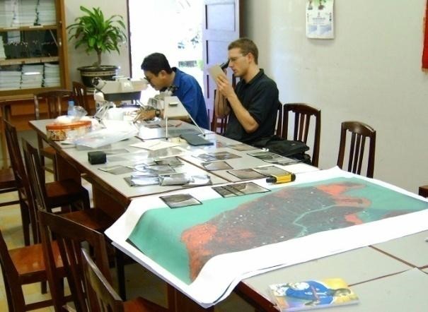
- RESEARCH ACTIVITIES
Research focuses:
- Application of GIS and Remote sensing in monitoring environment natural resources
- Modelling and simulation in land resources management
- Development of geo-databases, webgis for agricultural, resources and environment
- Development of image processing approaches using Google Earth Engine
- Development of UAV application
International co-operation:
- Center for Space and Remote Sensing Research, National Central University
- Wageningen university
- ITC (the Netherland,
- German Remote Sensing Data Center,
- Asian Institute of Technology
National co-operation:
- Space Technology Institute - STI
- Southern Satellite Technology Application Center
- Provincial Department of Environment and Natural Resources
- Provincial Department of Science and Technology
- National institutions and universities
- SELECTED PUBLICATIONS
Hironori Arai, Ryo Yoshioka, Syunsuke Hanazawa, Vo Quang Minh, Vo Quoc Tuan, Tran Kim Tinh, Truong Quoc Phu, Chandra Shekhar Jha, Suraj Reddy Rodda, Vinay Kumar Dadhwal, Masayoshi Mano, and Kazuyuki Inubushi, 2016 Function of the methanogenic community in mangrove soils as influenced by the chemical properties of the hydrosphere. Soil Science and Plant Nutrition. Vol. 62, http://dx.doi.org/10.1080/00380768.2016.1165598
Tuan Quoc Vo, C. Kuenzer, N. Oppelt, 2015. How remote sensing supports mangrove ecosystem service valuation: A case study in Ca Mau province, Vietnam. Ecosystem Services. Volume 14, August 2015, Pages 67-75, ISSN 2212-0416, http://dx.doi.org/10.1016/j.ecoser.2015.04.007.
QT Vo., OPPELT, N., and C. KUENZER, 2013: Remote Sensing in Mapping Mangrove Ecosystems - An Object-based Approach Remote Sensing 5(1), 183-201. doi:10.3390/rs5010183
QT Vo, C Kuenzer, QM Vo, F Moder, N Oppelt, 2012: Review of valuation methods for mangrove ecosystem services. Ecological Indicators 23, 431-446. doi:10.1016/j.ecolind.2012.04.022
KUENZER, C., CAMPBELL, I., ROCH, M., LEINENKUGEL, L., VO QUOC, T., and S. DECH, 2012: Understanding the Impacts of Hydropower Development in the context of Upstream-Downstream Relations in the Mekong River Basin. Sustainability Science. http://dx.doi.org/10.1007/s11625-014-0275-3
J Huth, C Kuenzer, T Wehrmann, S Gebhardt, QT Vo, S Dech, 2012: Land cover and land use classification with TWOPAC: towards automated processing for pixel-and object-based image classification. Remote Sensing 4 (9), 2530-2553. doi:10.3390/rs4092530
Claudia Kuenzer, Andrea Bluemel, Steffen Gebhardt, Tuan Vo Quoc and S. Dech, 2011: Remote Sensing of Mangrove Ecosystems- A review. Remote Sensing 3 (5), 878-928. doi:10.3390/rs3050878
Ottinger, Marco; Clauss, Kersten; Vo, Quoc Tuan; Kuenzer, Claudia, 2016 Assessment of coastal aquaculture ponds in Asia with high resolution SAR Data. EARSeL Symposium 2016
T.Sato, V.Q.Tuan, S.Beebout, 2014: Impact of introducing Good Agricultural Practices into Rice Production in Can tho, Vietnam. ASA, CSSA & SSSA International Annual Meetings, Long Beach, CA, USA; 11/2014
Vo Quoc Tuan, Nguyen Nhu Do, Cao Quoc Dat, Vo Quang Minh, 2013: The Potential of Landsat-8 data for Mapping Mangrove Ecosystem. Proceedings of the 9th International Conference on Geo-information for Disaster Management, 9-11 December, 2013. Ha Noi, Vietnam. (oral presentation)
Vo, QT., N. Oppelt., C, Kuenzer 2013. Quantifying Mangrove Ecosystem Services based on Remote Sensing and Household Surveys. Proceedings of the 35th International Symposium on Remote Sensing of Environment, 22-26 April, 2013, Beijing, China. (oral presentation)
VO QUOC, T., KUENZER, C., VO QUANG, M., and N. OPPELT, 2012: Mangrove Ecosystem Services in the Mekong Delta: Combining Socio-Economic Household Surveying with Remote Sensing based Analyses. Proceedings of the 32dn International Geographical Congress, 26-30 August, Cologne, Germany (oral presentation)